Monsoon Preparedness for Mining with Predictive Surface Hydrological & Drainage Intelligence

Monsoon Preparedness for Mining with Predictive Surface Hydrological & Drainage Intelligence

Aereo helps mines predict monsoon-driven water movement & accumulation, plan drainage proactively, and maintain safe, uninterrupted production continuity.

Why Monsoon Risks Mining Operations?

Lack of early visibility into site water flow, drainage conditions and water accumulation of sump leads to production disruptions, operational delays, and safety risks.

Be amongst the first to experience Wait and launch a viral waitlist. Sign up to be notified when we launch!

Unclear Water Flow Pattern

Water movement across and beyond the site is not well understood, resulting in unaccounted inflows and ineffective drainage planning.

Unclear Water Flow Pattern

Water movement across and beyond the site is not well understood, resulting in unaccounted inflows and ineffective drainage planning.

Plan vs Actual Mismatch

A mismatch between planned drainage capacity and actual water accumulation leads to sump overloading and reactive, unplanned interventions.

Plan vs Actual Mismatch

A mismatch between planned drainage capacity and actual water accumulation leads to sump overloading and reactive, unplanned interventions.

Changing Rainfall Patterns

Variability in rainfall intensity and timing disrupts drainage assumptions and can exceed the designed capacity of existing systems.

Changing Rainfall Patterns

Variability in rainfall intensity and timing disrupts drainage assumptions and can exceed the designed capacity of existing systems.

Inadequate Drainage System

Poor drainage systems lead to water pooling in critical production areas and haul roads, directly compromising site safety and equipment mobility.

Inadequate Drainage System

Poor drainage systems lead to water pooling in critical production areas and haul roads, directly compromising site safety and equipment mobility.

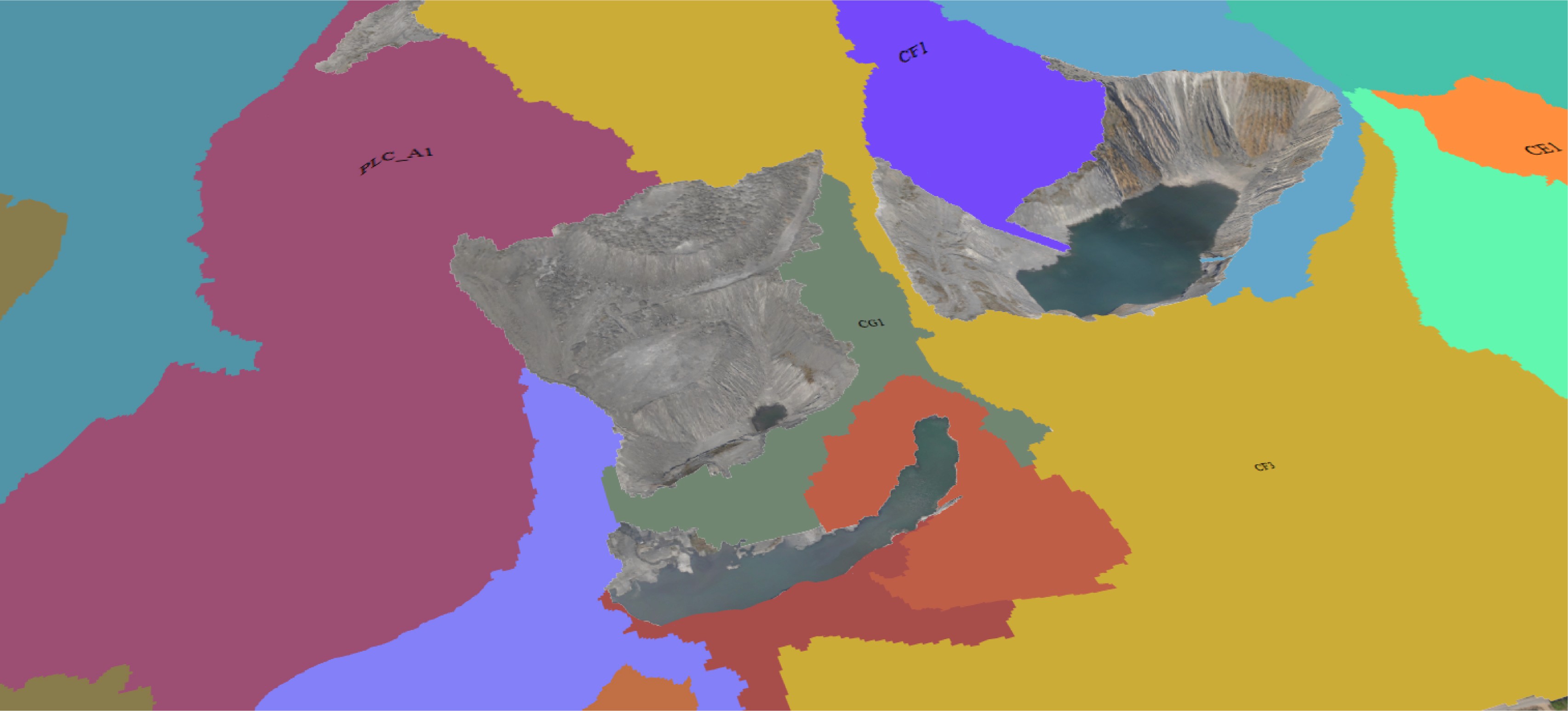
Engineered for Enterprise-Scale Monsoon Readiness

Proven in live mining operations to sustain productivity through the monsoon, replicable across your portfolio

Be amongst the first to experience Wait and launch a viral waitlist. Sign up to be notified when we launch!

Diverse Commodity Coverage

Applied across 13+ mineral commodities including coal, iron ore, limestone, chromite, bauxite, manganese, and others.

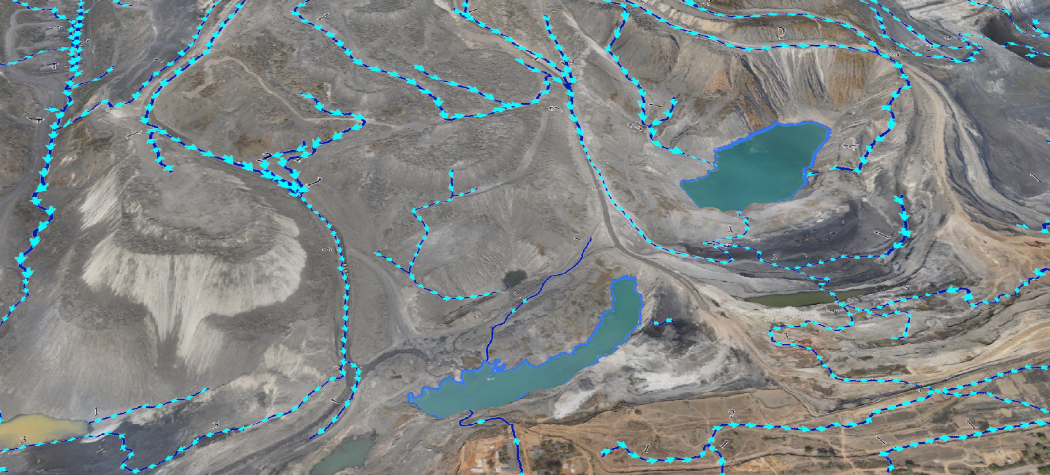
Comprehensive Drainage Analytics

Leveraging 10+ features like critical stream detection and drainage patterns, Aereo Cloud enables end-to-end drainage and surface hydrological assessments.

Extensive Analytical Usage

Aereo Cloud’s analytical capabilities have been leveraged 870+ times, demonstrating repeatability and operational reliability.

Monsoon Readiness Across Sites

Implemented across 40+ mines, enabling large-scale preparedness for monsoon conditions.

Large-Scale Area Coverage

Proven at scale, including deployment in India’s largest coal mine spanning 4,184+ hectares.

Inflow Quantification

Identified scenarios where runoff contribution reached 5 to 10 times sump capacity, highlighting hidden overflow risks.

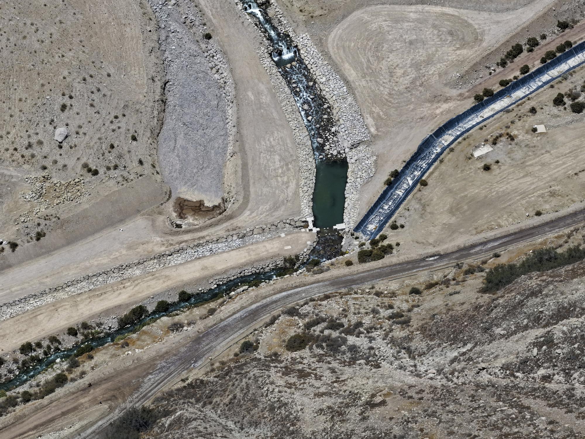
Ensuring Predictable Mining Operations During Monsoon

01
Risk Anticipation
Plan sump capacity with upstream inflow visibility to reduce overflow risk during peak rainfall.
Stage 1
02
Drainage Alignment
03
Water Optimization
04
Disruption Reduction
05
Environmental Protection
06
Operational Control

Execution Control Enabling Predictable Monsoon Execution

Execution Control Enabling Predictable Monsoon Execution

Certified Enterprise Drone Fleet

Largest fleet of Type-Certified, survey-grade drones with commercial UIN, ensuring regulatory-compliant and scalable deployments across multiple mines.

100% In-House Execution

No outsourcing. All surveys, processing, and QA handled by Aereo's teams, eliminating quality risks and timeline slippages from third-party dependencies.

Centralized Data Control via Aereo Cloud

All data is processed, stored, and delivered through Aereo Cloud, ensuring audit-ready traceability, secure storage, and zero fragmentation across cycles.

Proven at One of the World’s Largest Open-Cast Mines

 Aereo Cloud enabled predictive visibility into water movement across the entire lease, turning monsoon risk into planned control.

Be amongst the first to experience Wait and launch a viral waitlist. Sign up to be notified when we launch!

Full-Lease Visibility

50 sq. km of terrain unified into a single model, ensuring upstream zones influencing water flow were included in planning.

Catchment Intelligence

46 catchments mapped with drainage networks classified up to fourth-order streams, revealing how water moves across the site.

Water System Understanding

12 sumps and 2 pit lakes analyzed to establish inflow dependencies and accumulation behavior across the mine.

BG Image
Plan your monsoon before it impacts operations.

Build predictive, terrain-driven hydrological intelligence into your monsoon planning with Aereo.

© Copyright 2023, Aereo. All rights reserved.

© Copyright 2023, Aereo. All rights reserved.